Home » Course Layouts » Free Course Layout Udemy
Digital Land Surveying and Mapping. Instructor: Prof. Jayanta K. Ghosh, Department of Civil Engineering, IIT Roorkee.
0
2
English
English [CC]
- Learn basic syntax that can apply to any language.
- Learn what is a programming language and the basic concepts for beginners.
- Understand what is Javascript in it's truest form.
- Know the basic syntax of Javascript.
- Know some hidden quirks in Javascript.
Description
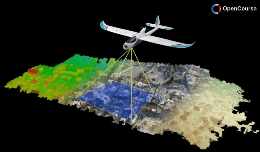
The objective of the course is to provide basics of digital surveying and mapping of earth surface using total station, GPS and mapping software. The course starts tith introduction to land surveying followed by fundamentals of total station and its working and measurements for land surveying. Then, fundamentals, working and measurements using GPS for land surveying will be discussed. Followed by mapping fundamentals, digital surveying procedure, working, data reduction etc. Finally, the course will deal with working and demonstration of a digital land surveying and mapping of an area. (from nptel.ac.in)
Course content
- Lecture 01 – Introduction and Applications Unlimited
- Lecture 02 – Fundamentals and Operations Unlimited
- Lecture 03 – Overview of Digital Land Surveying Unlimited
- Lecture 04 – Introduction to GPS Unlimited
- Lecture 05 – GPS Signal (Civilian Perspective) Unlimited
- Lecture 06 – GPS User Segment Unlimited
- Lecture 07 – GPS Positioning of Control Point Unlimited
- Lecture 08 – Demonstration of GPS Receivers, Software and Positioning of Control Point Unlimited
- Lecture 09 – GPS Position Unlimited
- Lecture 10 – Principle of GPS Positioning and GPS Observables Unlimited
- Lecture 11 – Errors in GPS Observables Unlimited
- Lecture 12 – GPS Data Pre-processing: Differencing Unlimited
- Lecture 13 – GPS Data Pre-processing: Point Positioning Unlimited
- Lecture 14 – GPS Data Processing: Baseline Processing Unlimited
- Lecture 15 – GPS Data Processing: Network Adjustment Unlimited
- Lecture 16 – Quality Assessment of GPS Surveying Unlimited
- Lecture 17 – Introduction to Total Station Unlimited
- Lecture 18 – Parts of Total Station Unlimited
- Lecture 19 – Accessories of Total Station Unlimited
- Lecture 20 – Handling and Setting of Total Station Unlimited
- Lecture 21 – Measurement of Distance Unlimited
- Lecture 22 – Measurement of Distance using TS (Total Station) Unlimited
- Lecture 23 – Measurement of Horizontal Angle using TS Unlimited
- Lecture 24 – Measurement of Vertical Angle and Height using TS Unlimited
- Lecture 25 – Errors in Total Station Unlimited
- Lecture 26 – Other Errors in Total Station Unlimited
- Lecture 27 – Errors and Quality of Surveying Measurements Unlimited
- Lecture 28 – Error Propagation and Survey Specifications Unlimited
- Lecture 29 – Basics of Vertical Representation Unlimited
- Lecture 30 – Contouring Unlimited
- Lecture 31 – Mapping Fundamentals Unlimited
- Lecture 32 – Mapping Basics Unlimited
- Lecture 33 – Mapping Software Unlimited
- Lecture 34 – Automated Mapping Unlimited
- Lecture 35 – Working Steps Unlimited
- Lecture 36 – Establishment of Control Point Unlimited
- Lecture 37 – Detailing of Digital Land Surveying Unlimited
- Lecture 38 – Demonstration of Digital Land Surveying Detailing Unlimited
- Lecture 39 – Data Preparation and Map Making Unlimited
- Lecture 40 – Overview of the Course Unlimited
N.A
- 5 stars0
- 4 stars0
- 3 stars0
- 2 stars0
- 1 stars0
No Reviews found for this course.

